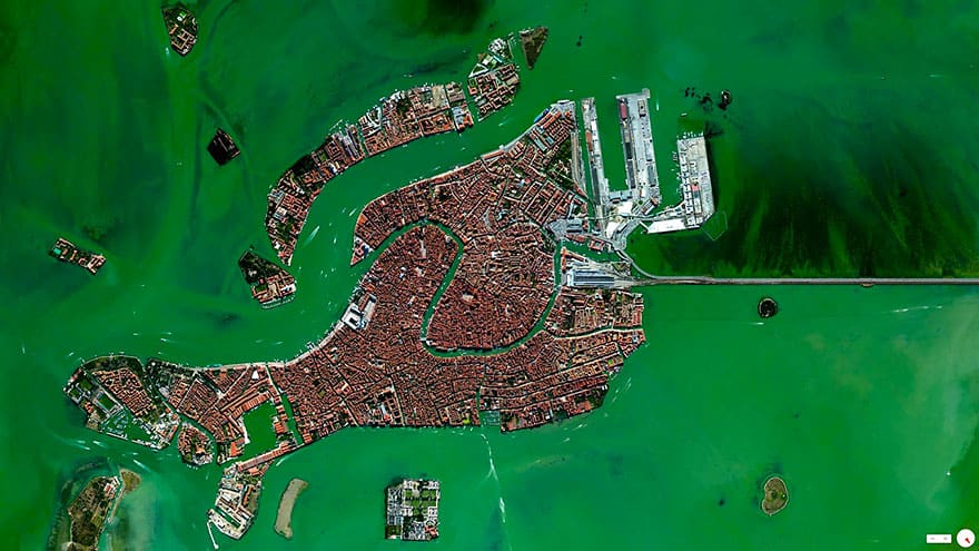
#41 Venice, Italy
45°26′15″N 12°20′9″E
#42 Discovery Bay Discovery Bay, California, USA
37°54′31″N 121°36′01″W. Discovery Bay is a waterfront community built on a network of man-made dikes in Contra Costa County, California, USA. Development of the area began in 1964 is now home to roughly 13,352 residents. As seen in this Overview, many residents have private docks with boat access to the Sacramento–San Joaquin River Delta.

#43 Inman Yard, Atlanta, Georgia, USA
33.800083, -84.451936. The Norfolk Southern Railway operates 21,300 miles of track in 22 states, primarily in the Southeastern US. Inman Yard in Atlanta, Georgia, pictured here, is one of the major railyards that houses a portion of the operation’s 3,648 locomotives and 79,082 freight cars.

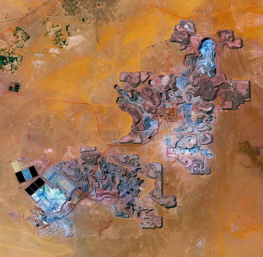
#44 Arlit Uranium Mine, Arlit, Niger
18°44′N 7°23′E. With just three days until the release of “Overview”, I’m sharing a few of my favorite images from the book. Here’s one from the chapter all about mining, ‘Where We Extract’. The Arlit Uranium mine is located in Arlit, Niger. French nuclear power generation as well as the French nuclear weapons program are dependent on the uranium that is extracted from the mine – more than 3400 tonnes per year.
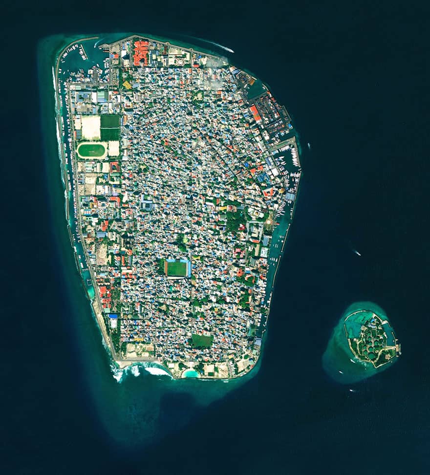
#45 Malé, Republic Of Maldives
41.75283°, 73.506694°. Malé is the capital and most populous city in the Republic of Maldives. With more than 47,000 residents per square kilometer (0.39 square miles), the heavily urbanized city constitutes the fifth most densely-populated island in the world. Malé and the other islands of the Maldives are located one meter (3 feet) above sea level.
Please share this compilation and comment your thoughts below!
This article (40+ Stunning Satellite Photos That Will Change The Way You See This World) is free and open source. You have permission to republish this article under a Creative Commons license with attribution to the author and TrueActivist.com